 November 1966, Kodak Baby Brownie, Ektachrome
Arnold Kolb, the man who taught me to fly, passed away April 27, 2011 at the age of 83.
Photos taken November 1966 were shot from a Piper J-3 Cub (NC) 7135H
Photos taken December 1967 were shot from a Piper PA-12 Super Cruiser N2783M
It is a challenge to shoot pictures from an airplane using a hand held camera. Opening a window for a clear view causes camera shake due to buffeting from windy slipstream. Shooting through the window causes blur due to vibrating plexiglass window.
Additional loss of quality is caused by conversion from slide to digital using the simplest of methods.
These photos were requested by my nephew, Ryan A.
.
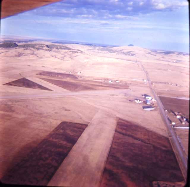
November 1966, Kodak Baby Brownie, Ektachrome
East of Spearfish, South Dakota
Black Hills Airport looking east.
Administration building, shop, slurry base, and hangars center right.
Farm of Clyde Ice, pioneer aviator, at extreme right foreground.
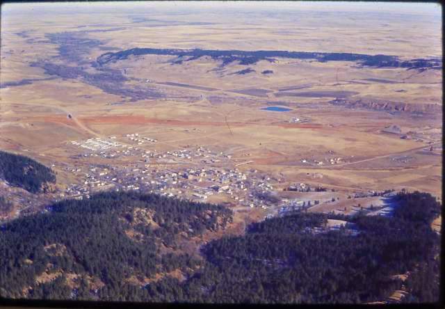 December 1967, Yashica, Ektachrome
Whitewood, South Dakota looking northeast.
Whitewood Creek and Valley is the drainage at far upper left.
The red streak in soil just the other side of town is new interstate
90 construction.
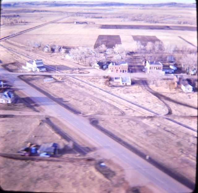 November 1966, Kodak Baby Brownie, Ektachrome
St. Onge, South Dakota looking north.
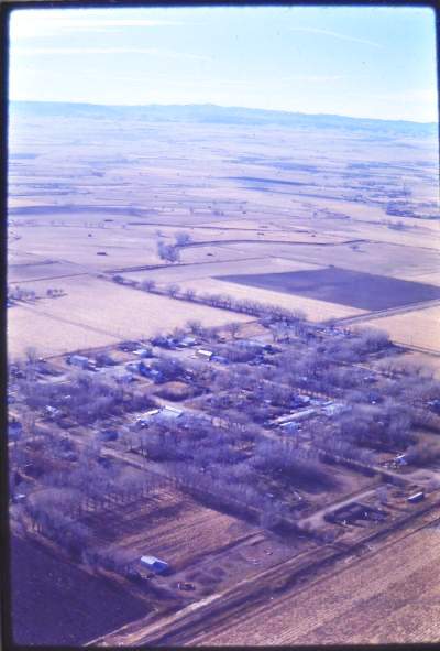 December 1967, Yashica, Ektachrome
Vale, South Dakota looking southwest.
 December 1967, Yashica, Ektachrome
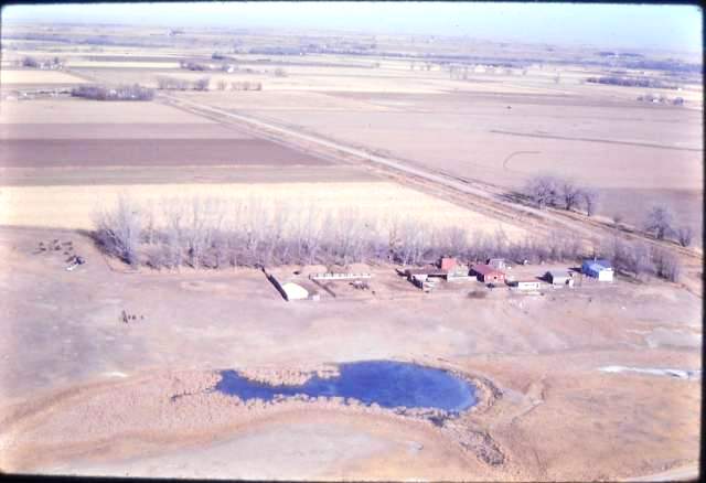
Farm of Blanch and Rubert Mathison a few miles west of Vale, South Dakota
looking north northeast.
 December 1967, Yashica, Ektachrome
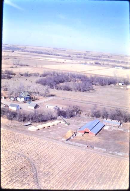
Farm of Elaine and Victor Albrandt approx one mile southwest of
Vale, South Dakota looking southwest.
 December 1967, Yashica, Ektachrome
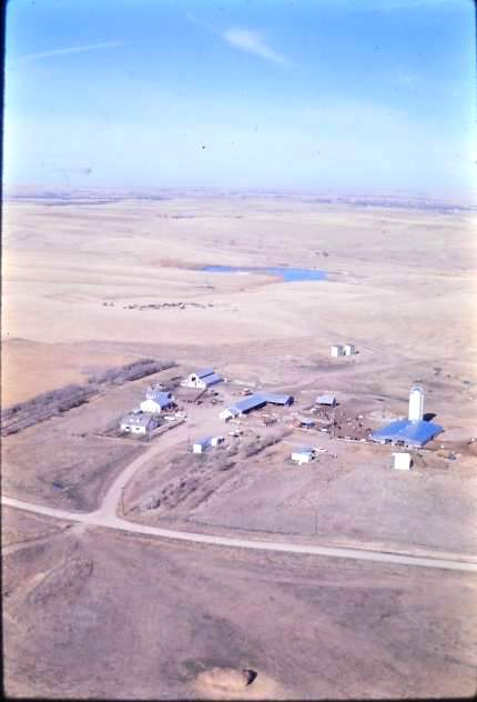
Ranch of Harrison Loop approx six miles south of Nisland, South Dakota
looking northwest.
 December 1967, Yashica, Ektachrome
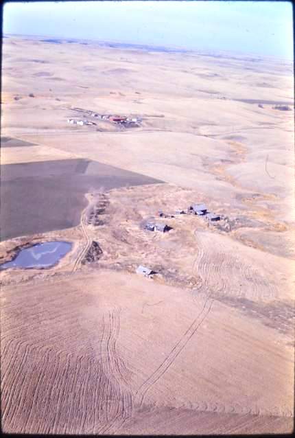
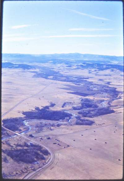
Uninhabited ranch formerly owned by Blanch and Rubert Mathison, foreground, looking northwest approx twelve miles north of Whitewood, South Dakota. This was the original 1910 homestead of Joshua Andrew Ramsey.
The Walter Grant ranch, rear.
 December 1967, Yashica, Ektachrome
Whitewood Valley looking southwest towards the Black Hills.
The old JB Ranch is at lower left.
 July 1969, Yashica, Ektachrome from Jason Assoc Mooney MK21
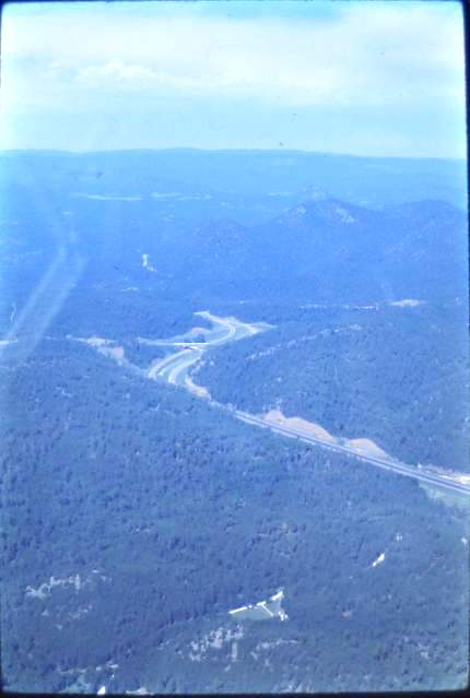
Could not open any windows so had to shoot through plexiglass window.
Black Hills and large wooden bridge, center looking southwest.
 July 1969, Yashica, Ektachrome from Jason Assoc Mooney MK21
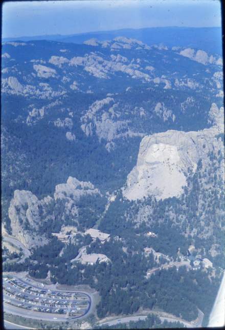
Black Hills of South Dakota.
Mount Rushmore Monument, center right looking west.
 July 1969, Yashica, Ektachrome from Jason Assoc Mooney MK21
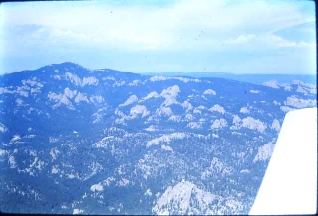
Black Hills of South Dakota.
Harney Peak, center left, and needles area, center and right looking west.
 July 1969, Yashica, Ektachrome from Jason Assoc Mooney MK21
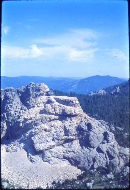
Black Hills of South Dakota north of Custer.
Crazy Horse Monument under construction looking northeast.
 July 1969, Yashica, Ektachrome from Jason Assoc Mooney MK21
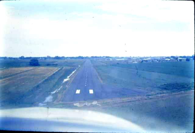
Ft. Collins Commercial Airpark, Ft. Collins, Colorado.
Mooney MK21 approach to landing towards the west.
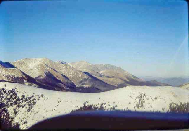
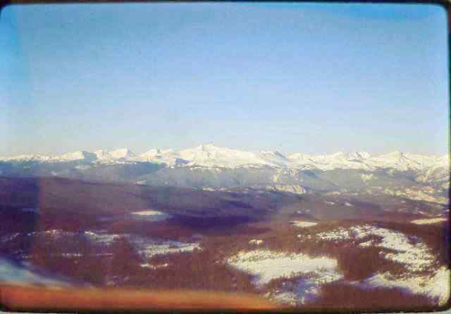 November 1970, Yashica, Ektachrome from Jason Assoc Mooney MK21
Colorado Rockies, snow covered in the distance.
Probably near Estes Park.
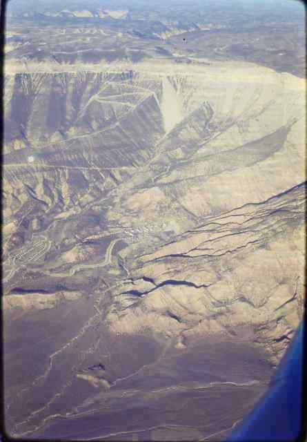 November 1970, Yashica, Ektachrome from Jason Assoc Mooney MK21
Just below center, and left.
A mining town on the barren western slope of the Colorado Rockies.
Probably near Nucla or Naturita.
 November 1970, Yashica, Ektachrome from Jason Assoc Mooney MK21
Topping a snow covered ridge of the Colorado Rockies.
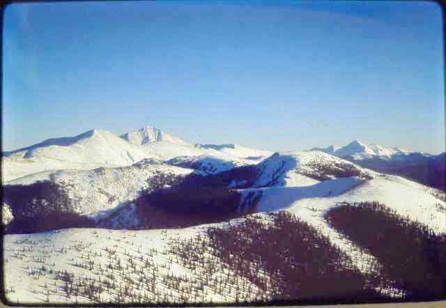 November 1970, Yashica, Ektachrome from Jason Assoc Mooney MK21
High altitude snow in the Colorado Rockies.
.
Last Modification June 17, 2011